Overview
A watershed is typically defined as the area of land where all precipitation drains to a common water body, such as a river or lake. A watershed includes upland areas, weltands, streams and water bodies.
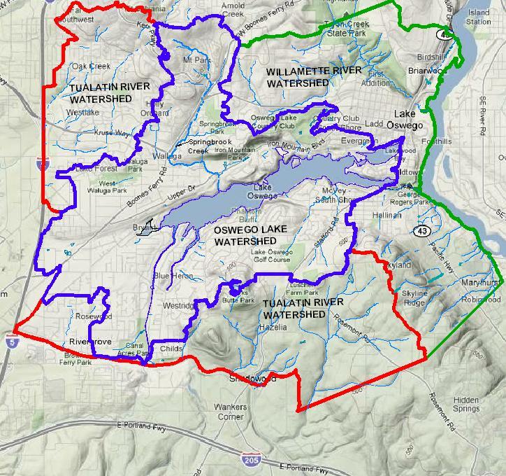
The Oswego Lake watershed is all the land that contributes water to Oswego Lake. It is comprised of 4,168 acres of land in Clackamas, Washington, and Multnomah counties in northwestern Oregon.
Water enters Oswego Lake through Springbrook Creek, Lost Dog Creek, Blue Heron Creek, and the Tualatin River (by way of the Oswego Lake Canal). Water exits the lake through Oswego Creek, which drains into the Willamette River.
The Oswego Lake watershed provides food, water, shelter, and many economic benefits and ecosystem services to the 21,550 people and diverse bird, fish, mammal and amphibian species that live there. The watershed contains 2,100 acres of single-family residential area, 123 acres of multi-family residential area, and 95 acres of commercial/industrial area. Impervious, or solid surfaces that generate stormwater runoff like rooftops, parking lots and streets, cover 1,235 acres, or 29%, of the watershed.

History
Oswego Lake formed naturally 13,000-15,000 years ago when an abandoned channel of the Tualatin River was flooded during the Missoula Floods (also known as the Bretz Floods).
Before European settlement, the Clackamas people and other Indigenous groups lived in the Oswego Lake watershed. They referred to the lake as “Sucker Lake” due to the abundance of sucker fish in its waters. The oldest known name for Oswego Lake, according to linguist Henry Zenk, was derived from the Kalapuyan language and referred to Oswego Creek as “sucker-place-creek,” reflecting the prominence of the fish in the area.
In the late 1800’s, the lake became popular as a summer vacation destination and recreational lake. By 1927 the lake was renamed Oswego. After World War II, summer cottages gave way to more and more permanent homes as the Oswego Lake area became the residential area it is today.
