Lake Oswego Land Resilience
What is Lake Oswego Forest Resiliency?
The idea of land resilience and community involvement requires a coupling of social and ecological resilience in rapidly changing landscapes affected by our warming climate. Land management is strongest when it adopts multiple perspectives of resilience. Resilient land that is actively managed using a systems based approach can respond to stress events (drought, extreme weather, fires, insect and pathogen invasions) while supporting wildlife populations, healthy soils, and healthy watersheds.
First Stewards
Indigenous peoples successfully cared for this land for millennia prior to European colonization and continue to do so today. The land that we now call Lake Oswego is the homeland of the Clackamas people and other native groups who relied on their natural environment and embedded knowledge of local ecosystems into their worldview, culture, food, craftsmanship and storytelling.
Tribes continue to use Traditional Ecological Knowledge (TEK), an on-going accumulation of practices that demonstrate relationships between living beings including people in a specific ecosystem. The Indigenous use of fire has been a particularly important care-giving tool for maintaining a mosaic of habitat patches that supports forest health by ensuring a productive, biodiverse landscape.
Using charcoal analyses to reconstruct the character of the fire regimes that existed in Lake Oswego, Western researchers are finding out more about how indigenous peoples deliberately used fire to shape the land. Their methods of controlled burning to enhance ecosystem health required extensive knowledge of seasonality and vegetation response. Prescribed fire is often used to mimic the low-intensity fire that would have naturally occurred on the landscape creating a more fire resilient and adapted landscape.
Increased Wildfire Risk in a Changing Climate
Increased forest fire activity across the western United States has been enabled by a number of factors, one of the leading being the pattern of increasing temperatures, a key indicator of human-caused climate change. Prolonged drought and heat evaporate moisture from the soil and vegetation making forested areas more vulnerable to igniting. Wildfires are burning hotter and more frequently, and as urban populations continue to grow and create new rural boundaries, fire will become a large part of the changing landscape.
Many communities in Lake Oswego lie within the wildland-urban interface. Decades of deferred maintenance, tree damage and woody debris from the 2021 ice storms, combined with periods of prolonged drought, progressing climate change, and the buildup of invasive plant materials have created conditions conducive to wildfire risk.
Steep slopes, dense non-native vegetation, and the interface between wildland and urban areas present high risk for wildfires. A forested area that is mainly confined to steep slopes that are topped by the residential areas increases the likelihood that a wildfire could develop with catastrophic results to residences – a single cigarette or coal from a barbecue has the potential to start a catastrophic wildfire in these conditions.
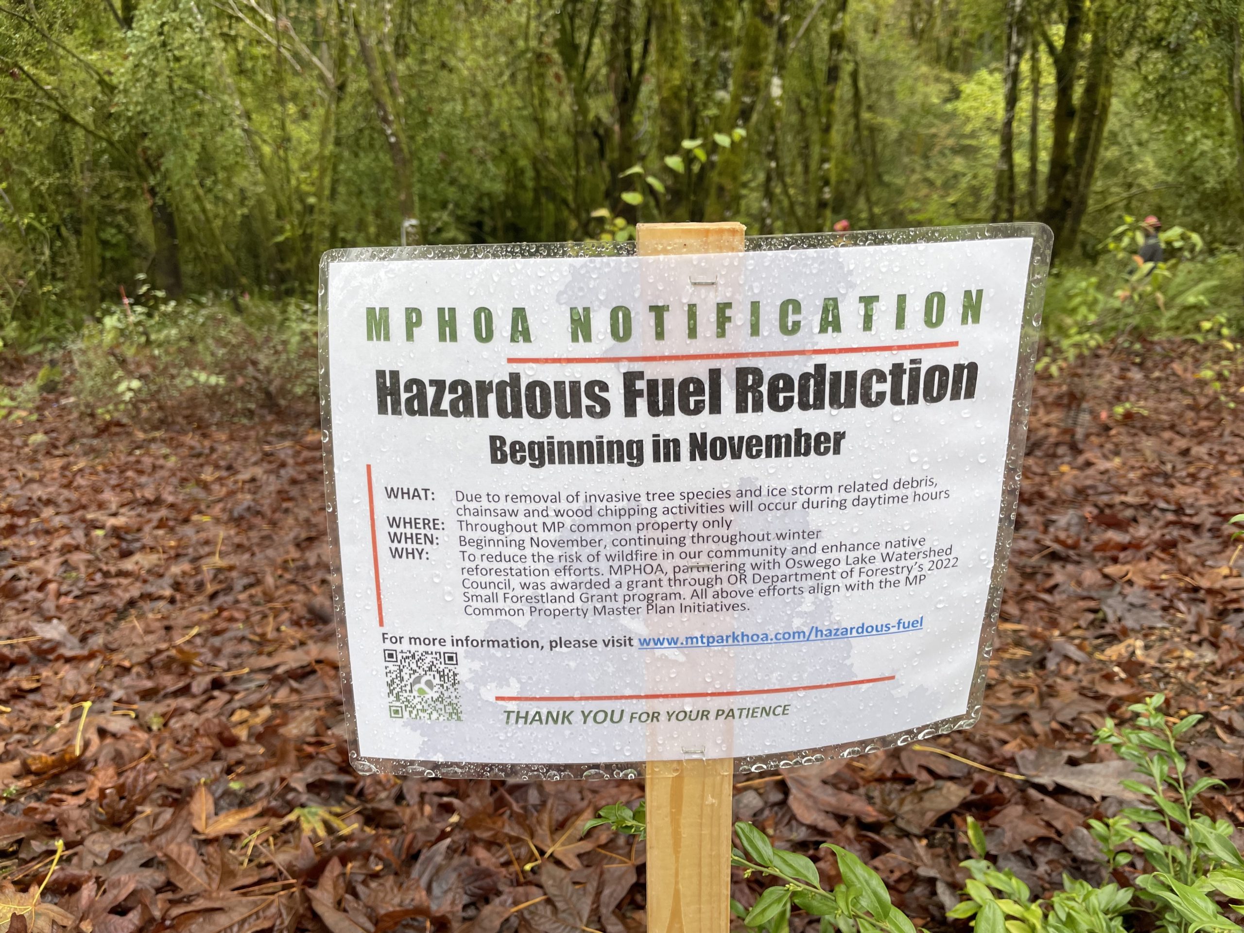
Hazardous Fuel Reduction
Fuel reduction projects and manual vegetation treatments have been utilized as a means of reducing catastrophic wildfire risk in the urban-wildland interface. When understory vegetation accumulates and ladder fuels build up, they allow fires to burn, ignite and spread faster, leading to high intensity, high impact fires.
When fire encounters areas of continuous brush or small trees, especially non native vegetation, it can burn these “ladder fuels” and may quickly move from a ground fire into the treetops, creating crown fires. Mechanically thinning out these dense tree stands aims to mimic low-intensity fires that would have naturally occurred on the landscape while promoting healthy forest successional processes. This will ultimately preserve many mature, native trees from going up in flames in the event of an urban wildland fire and prevent wildfire from spreading to homes.
Mountain Park Hazardous Fuel Reduction Project
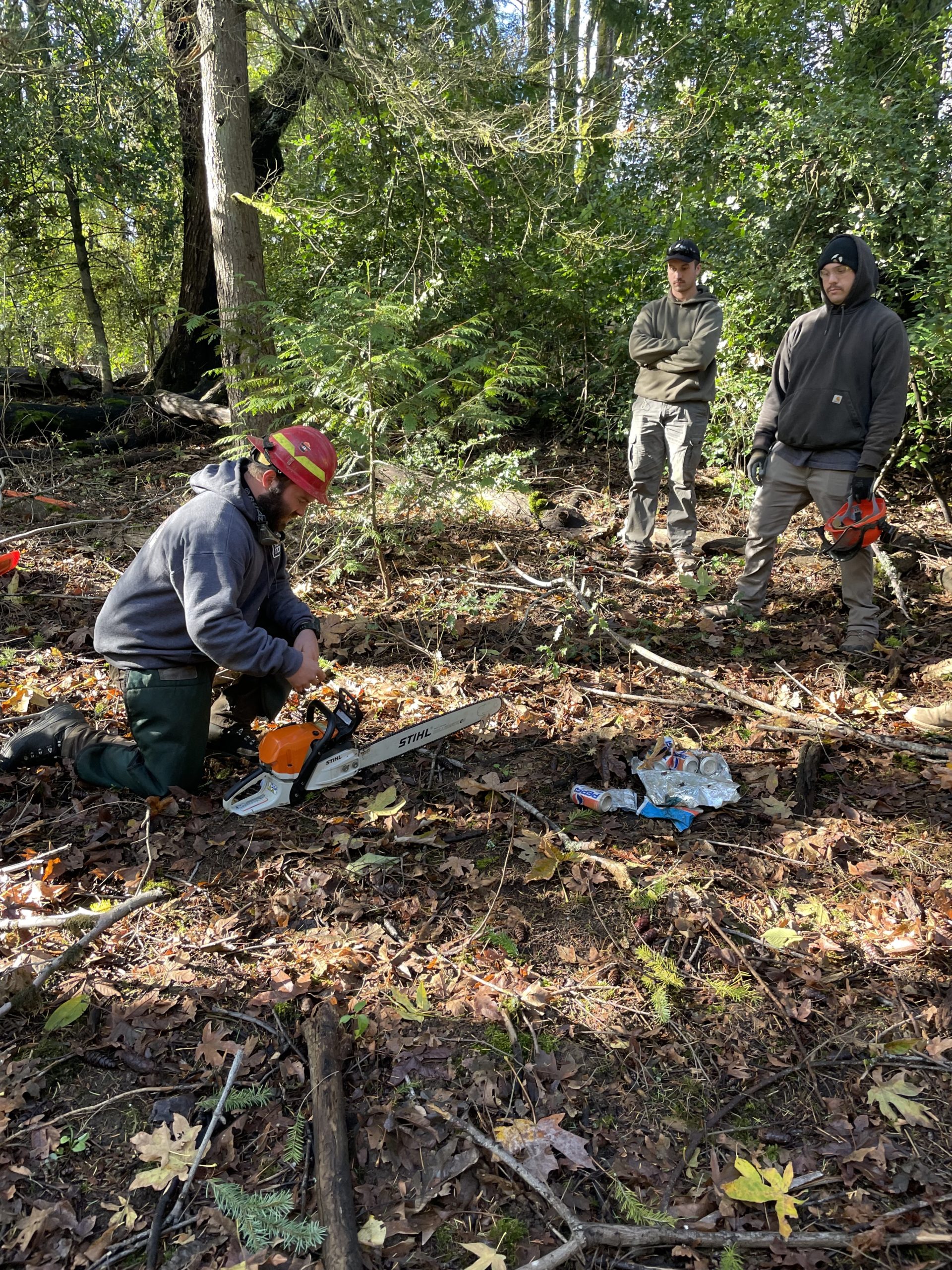
Mt. Park Homeowners Association and Oswego Lake Watershed Council are awardees of ODF’s 2022 Small Forestland Grant funding. We received a grant for a collaborative urban forestry project designed to reduce the risk of wildfire in the neighborhood of Mountain Park in Lake Oswego. Primary goals of this project include reduction of hazardous fuels in common lands, invasive species removal, promotion of healthy native plant communities, and supporting the formation of a Firewise community managed by residents of Mountain Park.

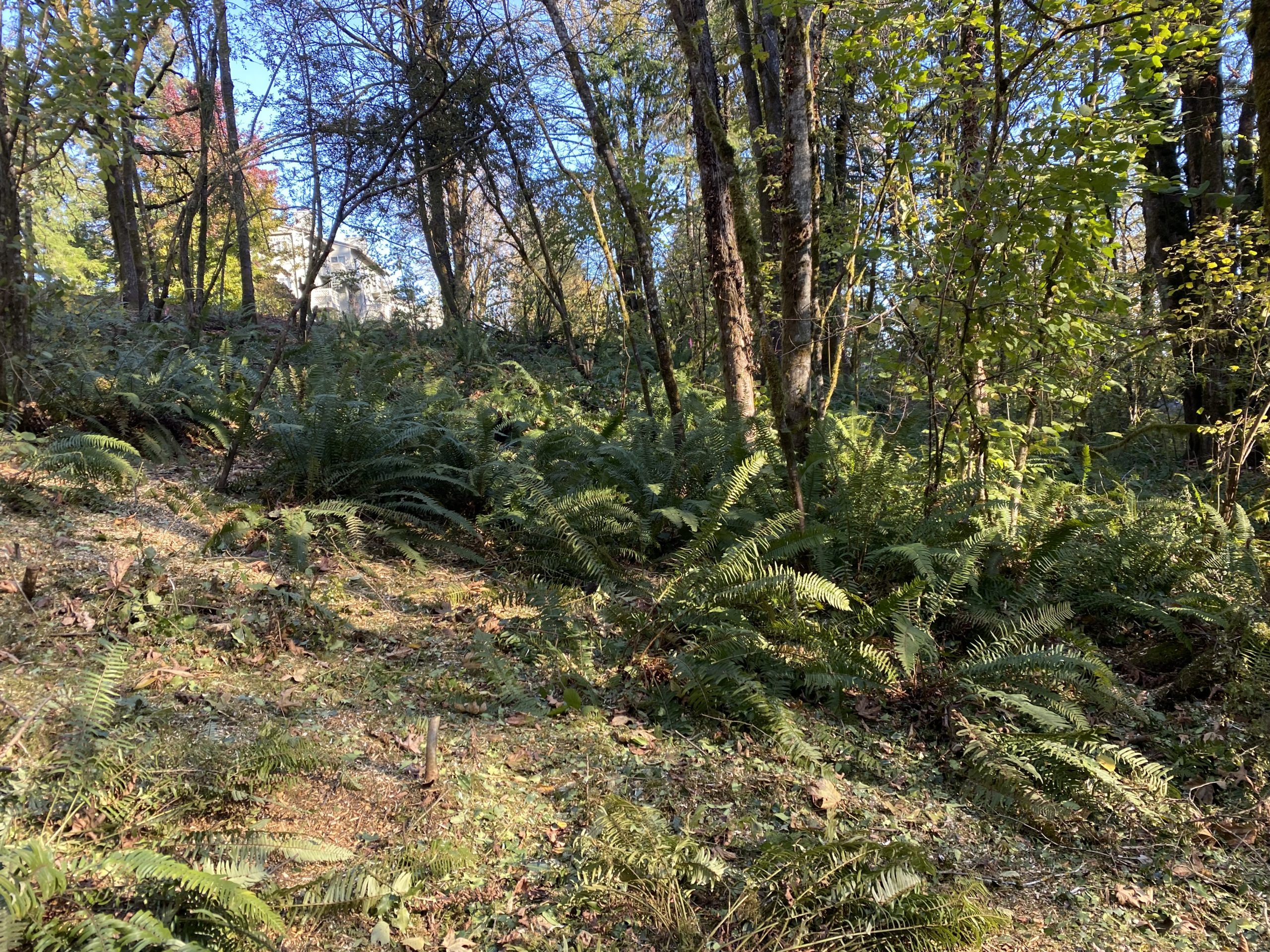
Small test plot where Mountain Park Home Owners Association (MPHOA) staff removed invasive shrubs and small trees, and replanted the area with fire resistant native species.
Community
Nearly 44% of Oregon’s lands are private and they make up a critical part of the ecological system that supports the conservation of endangered and threatened biodiversity. Because no single entity can resolve all urban-wildland interface concerns, cooperation between community partners and local governments is key. The Oswego Lake Watershed and its surrounding urban forest is an invaluable natural resource providing an array of community benefits and collaboration and conversation is integral to addressing the nuances of wildfire risk reduction. By working together with homeowners and the Lake Oswego Fire Department across public and private lands, this project will reduce the critical risk of severe wildfire in a changing climate.
Mountain Park Common Property Project Summary
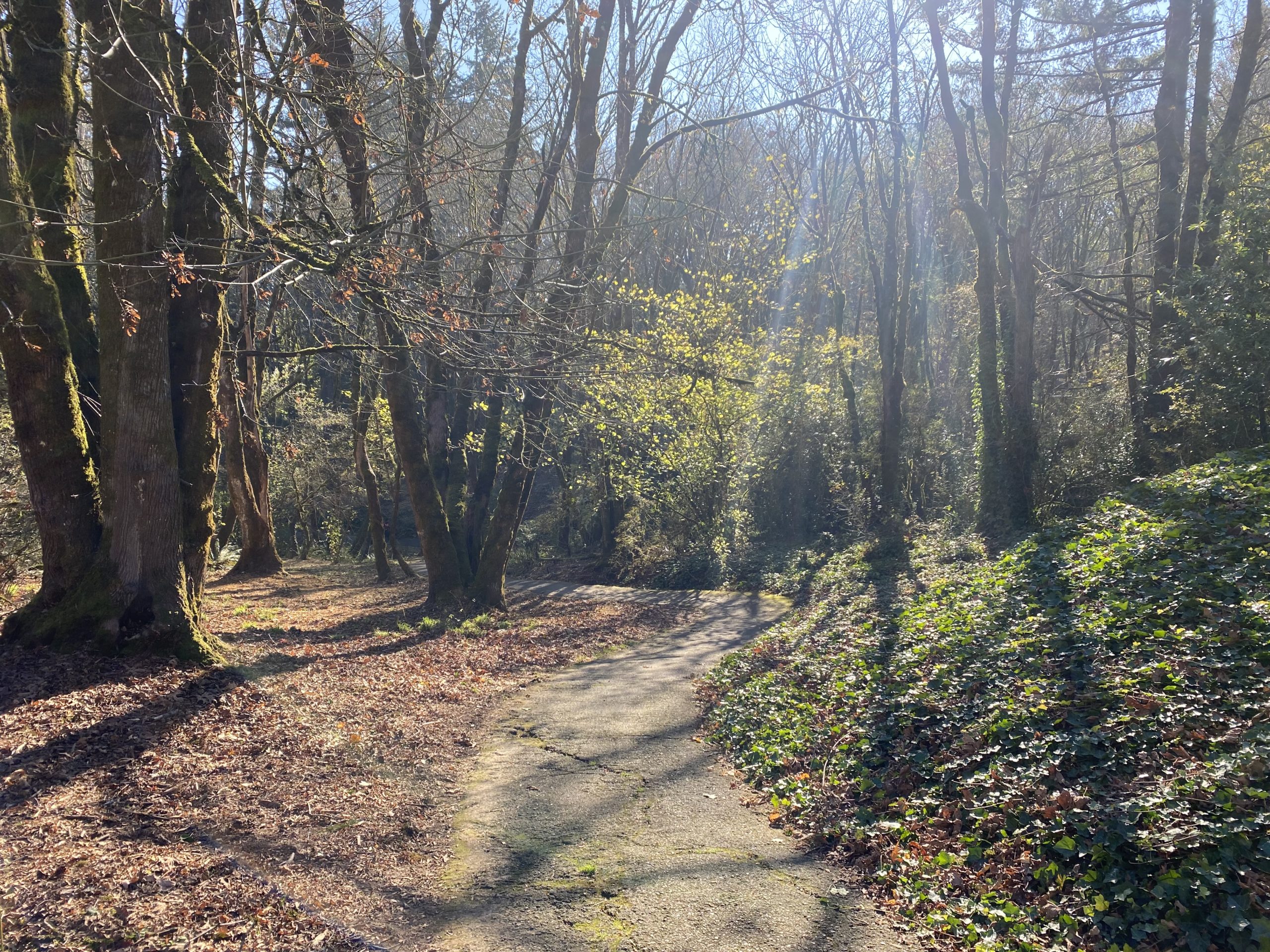
Mountain Park is the largest planned community in Oregon with over 8,500 residents living in a mix of multifamily apartments, condominiums, and single-family homes. Reduction of hazardous fuels and removal of select invasive species will take place on 120 acres of MPHOA owned common property, much of which is forested. The project area includes environmentally sensitive lands (forested, streamside, and wetland ecologies) and has a trails network that is open to the public. Steep slopes, dense non-native vegetation, and the interface between wildland and urban areas present high risk for wildfires.

The forested area is mainly confined to steep slopes that are topped by the residential areas, increasing the likelihood that a wildfire could develop with catastrophic results to residences – a single cigarette or coal from a barbecue has the potential to start a catastrophic wildfire in these conditions. This forested property is also infested with invasive plants (including ivy, European clematis, blackberry and invasive tree species) that threaten the resilience of the forest and health of native trees, shrubs, and wildlife within the system.
Description of Treatment Activities
Treatment focuses on hazardous fuel reduction including both ground and ladder fuels. Woody debris from the 2021 ice storm, and other accumulated debris, will be treated by a combination of collection and chipping and bucking into smaller sections to allow soil contact that promotes natural disintegration. Ladder fuels from woody invasive species will be removed with a major focus on English holly, common hawthorn and sweet cherry. Lower limbs from some native trees will be pruned to further reduce ladder fuels. Resulting fuels will be chipped and stumps carefully treated with herbicide to prevent regrowth. Removal of hazardous fuels within 20 feet of trails will be particularly thorough to reduce the possibility of human caused fire.
Where necessary there will be replanting with fire adapted native species that also meet anticipated requirements to flourish in a warmer climate with prolonged periods of summer drought. One of the benefits of this project beyond wildfire protection is the enhancement of a significant urban forest to support anticipated pressures from climate change and the removal of invasive plant species resulting in a healthier urban forest ecosystem.
This work will be completed by a combination of MPHOA Landscape Stewardship staff, ODF Fuels Reduction Crews, OLWC workforce development participants (Teen Rangers) and volunteers organized by OLWC.
Tasks and Timeline
Summer, 2022: Site Preparation and Permitting
- Outreach to MPHOA residents, community partners, stakeholders explaining both hazardous fuel reduction and the importance of addressing fire risk on individually owned properties.
- Preparation of site maps delineating invasive trees that will be removed and application for City of Lake Oswego Permits. Marking of invasive trees for removal, and other tree survey activities.
- Ivy (Hedera helix), Clematis (Clematis vitalba) and other invasive vines will be removed from trees and snags on 120 acres. Invasive vines will be cut and removed from 0 to 6 feet from ground level. Ivy will be piled to prevent rooting.
- Pruning lower limbs from select trees with loppers
- Hazardous fuel reduction within 20 feet of 2 miles of trail.
Fuels Treatment [June 15, 2022 – June 15, 2023]
The OLWC Teen Rangers and MPHOA Landscape Services Department (LSD) staff will assist in the implementation of this task.
- Invasive trees will be treated to reduce fuel loads. English hawthorn (Crataegus monogyna), English holly (Ilex aquifolium), Sweet cherry (Prunus avium) and other trees and shrubs on Lake Oswego’s invasive plant list will be targeted. These stumps and small diameter suckers/seedlings will be treated selectively with herbicide to prevent regrowth. All herbicide applications will be conducted as specified by the product label and in accordance with state and local laws. Applicators will meet all licensing requirements specified by state law.
- Select small diameter native tree saplings outside of sensitive lands (< 6 inches DBH) may be removed when the stocking density exceeds 200 stems per acre. Low thinning methods will be utilized. Suppressed, damaged and diseased individuals will be prioritized for removal in order to promote health forest succession processes. In stands where conifer stocking levels are below 100 stems per acer, hardwoods will be targeted for removal. Downed wood and other material forming ladder fuels will be cut and bucked. Leave trees may have lower limbs pruned. Habitat snags will be retained whenever possible.
- Dead woody material that is between 6 inches and 1-inches in diameter will be chipped. Chips will be scattered on site to improve local soil nutrients and moisture while preventing erosion.
- Material that is between 6 and 12 inches in diameter will be bucked into segments not to exceed 6 feet and will contact the ground.
- Material that is 12 inches in diameter or greater will be retained for ecological function. Retained logs will be moved or cut in a manner to reduce fire intensity adjacent to trees, infrastructure and private property.
- In total: 120 acres cleared of hazardous fuels including: 120 acres of non commercial thinning, 120 acres of variable density pruning, 120 acres chipping and 120 acres of bucking 6 to 12 inch diameter material.
November 2022 – ODF-FMT Work begin treating 100 acres.
Oregon Department of Forestry crews started work on November 1st beginning with invasive understory removal, finalizing invasive tree permits, and updating mitigation plans for diversifying the plant community. Currently, the crews are removing small diameter invasive trees through the area. MPHOA, ODF and OLWC staff participated in a chainsaw training on November 8th.
Resources for Mountain Park Residents

Local, Sustainable Jobs – LO Rangers
Lake Oswego Teen Rangers is a program established by the Oswego Lake Watershed Council as a way to support students serving the local community. Six students from Lake Oswego and Lakeridge High Schools will support the fuel reduction efforts and provide students the opportunity to engage with neighborhoods, develop new environmental job skills and learn more about habitat enhancement and catastrophic wildfire prevention in Lake Oswego.

Firewise USA
The national Firewise USA® program provides a collaborative framework to help neighbors in a geographic area get organized, find direction, and take action to increase the ignition resistance of their homes and community and to reduce wildfire risks at the local level.
Forming a Firewise community is voluntary and led by residents, with support and resources from community partners including the Lake Oswego Fire Department and Oswego Lake Watershed Council.
Benefits of becoming a Firewise accredited community in Lake Oswego:
- A dedicated space where homeowners can voice their concerns and ideas
- Attainable framework for creating defensible spaces
- Access to checklists for easy, routine tasks to make homes more resistant to ignition in the case of a wildfire.
- Endorsed by Lake Oswego Fire Department who will provide site assessments and recommendations
- FEMA Grants and other funding opportunities for long term wildfire hazard mitigation
- Utilizes community partnerships
- Provides educational material and ongoing research
- Brings community together over a common goal
- Serves as an example for other neighborhoods in Lake Oswego


“We make instant decisions in our efforts to protect homes during a wildfire based on what looks to be defensible; take the Firewise Prevention steps today to make sure you are ready for tomorrow.”
—Chief Don Johnson, Lake Oswego Fire Department
Resources for Lake Oswego Residents
Lake Oswego Fire Department
The Lake Oswego Fire Department has resources on their website that provide more information on home fuel reduction zones and defensible space and seasonal maintenance guidelines and checklist tasks to routinely address those fuel reduction zones.
Sign up for a Wildland-Urban Interface Home Assessment
The Lake Oswego Fire Department also offers assessments for homes in the Wildland-Urban Interface (WUI). Assessments focus on the home ignition zone and provide recommendations on ways to eliminate the fire’s potential relationship with the house. You can sign up here.
Firewise USA®: The national Firewise USA® recognition program provides a collaborative framework to help neighbors in a geographic area get organized, find direction, and take action to increase the ignition resistance of their homes and community and to reduce wildfire risks at the local level.
Click here to learn more about the Firewise USA® Program.


Additional Resources:
Information on Traditional Ecological Knowledge and Indigenous use of fire
Description of TEK
TEK vs Western Science
Gabe Shoeships – The Value of Cultural Burning in Forest Management
Tryon Creek Community Ecology Talk – Frank Lake on Fire Ecology and Management
Prescribed Fire: Why We Burn
The Role of Indigenous Burning in Land Management
Forest resiliency, wildfire risk and hazardous fuel reduction
https://www.pnas.org/doi/full/10.1073/pnas.1607171113
https://maps.tnc.org/resilientland/
https://catalog.extension.oregonstate.edu/sites/catalog/files/project/pdf/ec1573.pdf
https://www.nps.gov/articles/what-is-hazard-fuel-reduction.htm
Mountain Park 2019-2024 Common Properties Master Plan
http://mtparkhoa.com/wp-content/uploads/2019/05/2019-2023-Mt-Park-HOA-Common-Property-Master-Plan-02-06-2019-POSTED-5.6.pdf
Firewise Communities and steps to prepare your neighborhood for wildfire
Steps to becoming a Firewise community
How to prepare your home for wildfire
Lake Oswego Fire Department guidelines
https://www.nfpa.org/Events/Events/National-Wildfire-Community-Preparedness-Day
HOA and NA Communities in Oregon implementing Firewise communities and undergoing similar fuel reduction projects
https://www.oregon.gov/odf/programs/landscape-resiliency-project-results-map.pdf
Forest Park, Multnomah County https://forestparkconservancy.org/fire/
Linnton, Portland, Multnomah County https://www.portland.gov/fire/your-safety/firewise-community-program
Sunburst II, West Linn, Clackamas County https://www.sunburst2.org/p/Firewise-2
Barrington Heights, West Linn, Clackamas County https://www.barrington-heights.com/?s=firewise&apbct__email_id__search_form=
Deerfield Park 1&2, Happy Valley, Clackamas County
Oakridge-Westfir, Lane County – https://www.swfcollaborative.org/firewise